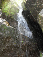
Tuesday, June 14, 2016

Third Day Trip To NH (Chipmunks & Waterfalls)

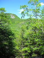
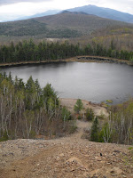
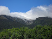
Tuckerman Ravine from Wildcat Parking Lot
    We set out early this morning knowing we were going to NH but not really sure what hikes we wanted to do. I’ve found so many off the beaten path places that look promising we knew we wouldn’t have nearly enough time to even scratch the surface. With yesterday’s heavy rain we figured the waterfalls would be impressive and knew we had to visit a couple. By the time we hit Gorham we both needed to find a bathroom so we made our way down to the Pinkham Notch visitor center at the base of Mt Washington.

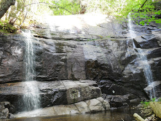
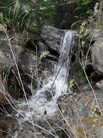
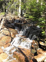
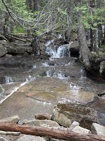
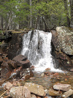
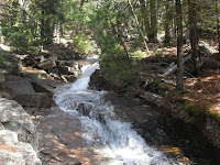
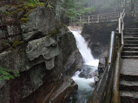
Thompson Falls at base of Wildcat
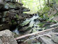
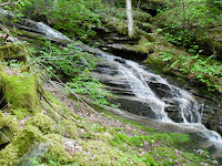
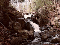
Above Thompson Falls at base of Wildcat    While in the area we decided to check out Thompson Falls. A while back I came across an old painting of the falls and have been wanting to see them in real life ever since. We started at the Wildcat Mountain parking area and followed the mostly flat trail out to the falls where along the way we got to see a daring chipmunk leap from one boulder to another across a stream. The waterfall was amazing, I can’t believe I’ve never been there before considering the ease of the trail and its short distance to the road. The rain really made the river swell, most of the pictures I’ve seen of Thompson Falls weren’t nearly as spectacular as  we saw today.

    I decided to cross the brook to get a view of the falls from the other side, where Benjamin Champney had done his painting from. With the water level being higher than normal I wasn’t able to rock hop my way across but did find a convenient log downstream that I successfully tight roped across. Above the falls there were some more neat little cascades, especially with the high water levels. There was even a small side brook that fell between two boulders creating a sort of cave that made for some awesome pictures.


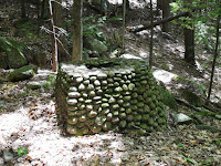
Madison Mine area in Jackson (old well)
Madison Mine area in Jackson (abadonned building)    Down the road a ways we turned off in Jackson to check out the roadside falls along the Ellis River. I also knew there was an underground mine tunnel in the area that’s on my list of places to find. I hadn’t anticipated searching for the mine so didn’t have a detailed map of the area but figured I could pull it up on Google Earth since it was already loaded, just to a different part of the map. And of course the map was loaded to a point right before the mine so it was too blurry to make anything out. I went searching anyway and quickly found a maintained trail through the woods presumably made by the locals. It lead past some clear signs of old civilization. There was what appeared to be an old stone well surrounded by small stone structures that looked like they once housed natural spring water. I almost missed it but there was also a wooden structure with a stone foundation. I took some pictures of the inside but it was too muddy to go in. After scouring the hillsides with no signs of the abandoned mine I gave up my search. Now that I can view the map I can see I was right around the corner from where the mine should be located, maybe 100 feet or so. I’ll definitely be going back to search for this one again.

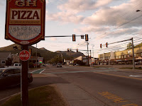
GH Pizza at Fay Wayside Area
Chipmunk at Fay Wayside Area    Starving, we cut across the Bear Notch Rd up to the Kancamagus Highway and made it to Lincoln just before White Mountain Bagel closed at 3:00. Jaime got her favorite sandwich there while I got a Souvlaki from GH Pizza. The last two times we went I got one to take home and eat cold so I wanted to have a warm one, the way it was meant to be. We went to my favorite picnic spot at Fay Forest along the river to eat our delicious meals and were visited by a chipmunk and then a red squirrel, both who posed for pictures. The chipmunk got so close I could have reached out and touched him, at one point we thought he was going to climb up Jaime’s leg. I think if I had food he actually wanted he would have eaten it right out of my hand. And as soon as the chipmunk left, a red squirrel took his place, getting close but not nearly as close as the chipmunk. I love little tree rodents so it was an excellent and very entertaining lunch.

Kinsman Notch
    From there we headed into Kinsman Notch so I could check out another waterfall just a mile or two up the road from Waternomee Brook which we explored a couple weeks ago during drier weather. I knew the falls would be raging today and wanted to check them out. We’d been to Clough Mine Brook one other time last Spring but only took a couple pictures from the pull off. This time I wanted to follow the brook up to some rock slabs known by bushwhackers as the Waternomee Waterslides.

Clough Mine Brook in Kinsman Notch
Waternomee Waterslide on Clough Mine Brook in Kinsman Notch    The brook was incredible with one cascade after another, zigzagging their way down the mountainside. Most weren’t huge, maybe six foot drops or slides but they were all spectacular in their own way, certainly worth the trip, I even got to see one of them through a small cave. Then came an amazing ‘z’ shaped waterslide that cut through a ledge, unfortunately some of the view was blocked by a recently fallen tree, but man was this one something special. I figured I’d turn around here but could see some light up ahead and decided to go a little further. There were quite a few blowdowns along the brook as the terrain got more treacherous the higher I got, erosion flanked the narrow streambed making travel a little more difficult. I kept telling myself I’d turn around at the next cascade, hoping to find something noteworthy to turn around at, the peeing tree would work. With the high water levels, the brook came pouring over a rock that a large funny looking tree was growing out of. I’d turn around at the tree.
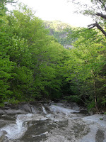
Waternomee Waterslide on Clough Mine Brook in Kinsman Notch    And there they were, the Waternomee Waterslides, pouring down a hundred foot ledge in the open sunlight, splashing into the small pool below the slanted wall of rock. I made it. Seeing something like that is awe inspiring when its on a path but when you stumble across it along a trail-less brook its something entirely different. To think that a waterfall this size doesn’t have a path to it is just insane. It literally took my breath away. Might have found a cool rock at the bottom of the falls that I would add to the collection of stones I planned on bringing back. I’ve been good lately but the large lumpy red rock was something I just had to have.

    I carefully made my way up the rock slab, trying my best to avoid the trickles of water that strayed away from the main fall. The view opened up as I got higher, closing in on the cascades at the top of the waterslide. It reminded me of the Basin Cascade Trail where the water just keeps tumbling down flat rock ledges with no real end in sight. I stopped just shy of the top, knowing I would see something above that would beg me to continue on. But I was gone long enough and very slowly made my way down the dry portion of the waterslide, cutting across it side to side to alleviate some of the steepness.
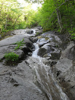
Waternomee Waterslide on Clough Mine Brook in Kinsman Notch
Hole I fell into  on Clough Mine Brook    I grabbed my red rock at the bottom and started my descent. Down a little further I stopped to examine my other cache of rocks, deciding to leave the two smaller ones behind and only grab one from that stash. So with a ten pound rock in each hand I carefully made my way down, opting to bushwhack rather than rock hop in order to save time. I took a step, no different from any other step I’d taken, only this time my foot didn’t land on solid ground. A thin layer of soil covered a gap between rocks and my entire leg disappeared into the forest floor. My outer thigh smashed into a rock, stopping my leg from going in any further. My natural instinct was to pull it out as fast as I could just in case there was an animal in the now exposed hole that wanted to eat me, but I could tell by the pressure that yanking it out would break a bone or two. I was able to turn my leg and pull it out with nothing more than some scratches and bruising, that could have been a lot worse. I did manage to hold onto both of my rocks and my bladder, didn’t even come close to peeing myself. Checked the backside, yep, good there as well, and I carried on, knowing that my knee wouldn’t be feeling too good come morning. I was right but it wasn’t that bad all things considered. I turned back after a few steps to photograph the hole and almost couldn’t find it, you would never suspect it was there, the ground looks perfectly normal. The pitfalls of bushwhacking.

Porcupine Brook in Kinsman Notch
    I knew that was about it for me for the day, it was starting to get late anyway. We checked out the next pull off just a stone’s throw down the road which had a neat waterfall coming down beside an enormous boulder with caves in it. There’s another stream just a few feet away as well, both of which I plan on exploring at some point, a kind of two for one deal. The area was too broad and dark for the pictures to really come out though, but I have a feeling there’ll be some interesting cascades up higher. I haven’t been disappointed by Kinsman Notch yet.

Cave along Lost River in North Woodstock
Sabaday Falls Pool    Closer to town we stopped at a pull off we’d noticed last time and went down to check it out. The ledges and giant boulders offered no safe way down to the stream, until I noticed a cave. Between the ledge and a boulder was a passageway to the stream, a fifteen foot cave that lead right down to the water. Me being me, I had to crawl through it, winding up at a small rocky beach on the shore of the river. The cave was made up of an awesome looking quartz that really made me wish I had my chisel and hammer with me. Its not often you get to crawl through a cave that leads down to a river. It was something straight out of Lost River which is fitting because its actually on the Lost River, just a few miles downstream.
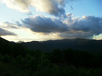
Bear Notch Road    We gassed up and made our way back over the Kancamagus, stopping at Sabaday Falls along the way. When we stopped there a month ago it was raining and we were exhausted after a long day so Jaime didn’t go to the falls. This time she was determined and made it without any trouble. We got some cool pictures, she even accidentally found a setting on the camera that will really come in handy, the colors are so much more vivid now. We were even able to accurately capture how green the pool below the falls was. Jaime requested we go back down Bear Notch Road the way we’d come so we could stop at the view points along the way since we didn’t have time on our way through before.

Dairy Queen in Bartlett NH    The goal was to make it out of NH before dark due to some construction that makes driving at night rather difficult but we were hungry and decided to stop at our favorite Dairy Queen. Sometimes we’ll have a craving for Dairy Queen, not the three we have here though, specifically the one in Bartlett or North Conway. I washed up my leg in the bathroom which burned like hell but the cut wasn’t too bad, I did notice I was starting to limp though. I could feel my knee hyper extending as it slipped into the hole but somehow contorted myself to stop it before too much damage was done. We ate in the lower parking lot looking over the lamps and picnic table before starting our journey home. The section of road that was all torn up and under construction was horrible but the rest of the trip wasn’t bad, except for the fact that we were both dead tired. Jaime was asleep before I even hopped in the shower. I was out not long after. Another terrific day in the mountains that feel more like home than home does.
Matt at Waternomee Waterslide on Clough Mine Brook

Wednesday, June 1, 2016

Another NH Day Trip (Noble Falls)

    Yesterday was supposed to be gorgeous, and this time it actually was, so we decided to make a day trip to NH. We’d been planning on going back since a few weeks ago when two of the places we wanted to eat at were closed for the day. So we got up early and left the house around 7:00. We took the same route as last time to Gorham which takes just over three hours, neither of our stomachs were doing too good so we had to stop for emergency pooping along the way.

    We got some Gatorade at the Gorham Walmart and attempted to find Alpine Cascades but came up empty handed. I know where it is on the map despite its lack of a trail but finding the best way to it is what’s difficult. We can walk along an old railroad bed turned ATV trail if we have to but its in the direct sunlight for over a mile plus its all on crushed gravel and dirt which my ankle doesn’t appreciate. I thought I found a more direct, wooded route but we couldn’t find the road we were looking for because there were no road signs. We were okay with that because it was really freakin’ hot and being out in the open sun wasn’t sounding too appealing.

    So we moved on to Littleton so we could get Jaime’s birthday fudge since they were closed by the time we got there last time. We got a pound and a half which should last us awhile. I went to a consignment shop and a thrift store but the antique place I really wanted to go to wasn’t open, they have old maps and post cards which is actually the best way to find out about abandoned trails.

Fay Wayside Picnic Area in Lincoln NH
    From there we went to Lincoln to get lunch at White Mountain Bagel. They’re a bagel place that makes amazing sandwiches with so much meat you can barely fit it in your mouth. Jaime of course told me that I shouldn’t have a problem with it because I love putting big meat in my mouth. We took them to the Fay Wayside picnic area to eat along the river, one of our favorite places to have a picnic.
Waternomee Brook Cascades in Kinsman Notch NH
    Not wanting to stray too far from Lincoln since we were determined to eat at Black Mountain Burger for supper, we’d decided on searching for a waterfall on Cannon Mountain but wanted something smaller first while digesting our delicious bagel sandwiches. Since Jaime didn’t go up Waternomee Brook with me a year ago she wanted to do that. It appears to be nothing more than a random brook that passes under the road but just a short ways up are actually a number of stunning cascades. Of course they were much better when I did them in the Spring of last year but it was still fun as hell. Jaime enjoyed climbing up the rocks of the steep brook. The black flies were horrible but that’s to be expected this time of year.
Waternomee Brook Cascades in Kinsman Notch NH
Waternomee Brook Cascades in Kinsman Notch NH    When I last visited the brook it would have been impossible to climb up it due to the insane amount of water. This time it was low enough to climb up right alongside the falls. I got to scratch another item off my bucket list by sticking my head under a waterfall to cool off. I’ve always wanted to but never really had the right opportunity or safe place to do it. It was as refreshing as I’d always imagined it to be. On our way back down I found a beautiful quartz rock by the waterfall and got some pictures of it posed beneath the fall before taking it home, my only rock of the trip. See, I’m doing much better, only one. The crystals in it are so thick they look like glass.

    The main fall which slides down a steep rock for about thirty feet wasn’t nearly as intense as it had been last time but that gave me the opportunity to explore. I actually got to go up the ledges that the water covered in the Spring which was pretty cool, there was even a view from the top. The brook continues on up the side of Waternomee Mountain but we stopped there since the water level was so low, but I’ll be traveling up it further next Spring. While I was exploring Jaime took off her shoes and stuck her feet in the pool below the falls and relaxed before making our descent.

    It was starting to get late so we scrapped the idea of searching for an abandoned mine and headed for Cannon Mountain. What was once an extensive bushwhack to a recently rediscovered waterfall  has turned into a short hike along a trail after a photographer realized the locals had a path leading to the forgotten Nobel Falls. The directions were right, you would never imagine there was a maintained path there. I think its used by skiers during the winter months but it makes for an excellent hiking trail that leads directly to the falls.

Noble Falls / Bridesmaid Falls on Cannon Mountain NH
    Noble Falls, now known as Bridesmaid Falls to the backcountry skiers, has got to be one of the most majestic I have ever seen. The fact it isn’t on any maps or trail guides is astonishing. Even in the low water it was incredible. Out of nowhere the small stream pours over an enormous rock cliff. The ledge is so high its not really possible to capture it all in a picture. Not only that, there’s actually two waterfalls, one on each end of the cliff. I got to touch it, both of them, but wasn’t able to wet my head like I did at Waternomee. The sandy pool at the bottom would be perfect to splash around in though. I’m still amazed at how incredible Noble Falls is, just wow.

Below Noble Falls / Bridesmaid Falls on Cannon Mountain NH
    Through research I’d learned that there was actually another waterfall just a tenth of a mile or so downstream, so downstream I went in search of Plimpton Falls. But first there were some really cool rock formations along the riverbed I had to check out. At one point a slab of rock jutted out over the brook like a plank on a pirate ship. I can’t wait to see these lower falls in the Spring or after a heavy rain.


Plimpton Falls on Cannon Mountain NH
    Getting down to Plimpton Falls was easier said than done. Tenth of a mile doesn’t sound so bad on paper but when its straight down with no trail whatsoever, it gets a little tricky. I could tell there was something special down there because I stood at the top of it and watched the water disappear over the edge. Using fallen trees and their comrades who had yet to succumb to gravity,  I carefully lowered myself down the steep ravine, catching glimpses of the falls from beside it.
   
Plimpton Falls on Cannon Mountain NH    Although not a sheer drop off a ledge like Noble Falls, the water cascaded down steps, one after another after another for what must be a hundred feet or more. Its hard to believe there can be two such unique waterfalls just a few hundred feet from each other with no real trail to them. Its really a shame more people don’t get to see these. The mosquitoes were swarming me so I didn’t stay long but I did manage to get some good pictures of me with the falls using the timer on my camera. Not wanting to leave Jaime waiting I hurried back up the impossibly steep slope. Every step was bringing me back two, sliding down the dead leaves and loose dirt beneath them. So instead I leapt from tree to tree, holding on tight, getting my footing, and then launching myself up to the next one. It worked but man did that tire me out. I think I almost passed out at one point but couldn’t let myself because Jaime was still up ahead of me and if I fell it would have been a long way down. I made it up rather quickly and stopped for a drink, then proceeded to swallow a fly during all my huffing and puffing. I hope he died a slow and painful death for discomfort he caused me.

Thai Burger at Black Mountain Burger in Lincoln NH
    We certainly earned our supper at Black Mountain Burger, which was delicious like always. I got a new one this time, a Thai burger with peanut slaw on it, it was certainly interesting. Jaime got the Brie and Bacon with maple mayonaise, one of our favorites. The buffalo mac and cheese balls were incredible as well.

GH Pizza in downtown Lincoln NH
    Before heading out we stopped at GH Pizza so I could get a Souvlaki to go which I had tonight after work, my mouth is watering just thinking about it. I also stopped at Price Chopper to see if they had anything good to bring back with me, I only got a package of blueberry muffin tops, the place looked pretty well picked over after the holiday weekend. We ended up leaving town at 8:00, made it down the Kancamagus before it got completely dark, oh and Jaime saw a moose along the way, and were home just after midnight. No rain at all so despite the construction areas on the way back it was smooth sailing, nothing like last time. Jaime even slept a bit on the highway. I wanted to but waited until we got home. Another amazing day that only makes me want to move there more.

Friday, May 27, 2016

Exploring Grotto Cave in Otis Maine

    Yesterday was Jaime’s birthday so today continued her four day celebration. We got together with her father for lobsters and some exploration. A few years ago I read about a cave near his house, where Jaime grew up, but he had never heard of it. He had been to the area it was located though, in fact right on top of it but never knew there was a cave down below. I copied the information into a word document which is good because the geological website it was featured on appears to be gone. With no real directions on how to get there I did some research on Google Earth and got a pretty good idea where to start. Today was the day to begin the search.

West Shore Rd in Otis Maine along Beech Hill Pond    With my research and Jaime’s dad’s knowledge of the area, as well as a couple firsthand accounts he’d heard from local friends, we knew we were heading in the right direction. Boy is it nice to do these sorts of things with a local, we parked at the boat launch and Dicky knew the guy who was washing his truck and we got some directions from him which pretty much matched up to what I had gathered from my research. He referred to the cave as ‘the bear caves’. So we headed up a gravel road that looked like nothing more than a driveway. He told us we’d get a little wet by the swamp this time of year which seemed about right because I knew we had to follow the road to the edge of a swamp before cutting uphill through the trees.

Grotto Hill swamp Grotto Cave near Beech Hill Pond in Otis Maine    Sure enough we came to the swamp which was dammed up pretty good by beavers. The road was under a few feet of water with the dam running right along the side of it. We skirted around the first dam, crossing a small brook, but came to another much longer dam that we couldn’t easily walk around. So we tight roped a hundred feet or so across it. We got a little wet but no one fell in. The dam brought us up close and personal with the beaver hut but there was no activity.

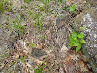
Snakes above Grotto Cave near Beech Hill Pond in Otis Maine    On the other side of the dam we made our way into the woods and off the muddy jeep road. All we knew was that we needed to get to the top of the hill so we made our way up, crossing multiple atv trails along the way. Luckily it was kind of chilly today which prevented the sweat from pouring as we wandered through the woods, eventually making it to the top of the ridge. We followed the ridgeline for a couple minutes before spotting a clearing up ahead. Jaime and I stopped to watch a couple of snakes sun bathing while Dicky made his way through the clearing, yelling back that we’d made it to the top and there was one hell of a view.

Grotto Hill above Grotto Cave near Beech Hill Pond in Otis Maine    When he was a kid he’d been camping there before, right on top of the hill with a beautiful view looking out over Beech Hill Pond and Graham Lake as well as a few ridgelines of nearby mountains. We hadn’t expected such a spectacular view, figuring trees would surely obscure it, but there was a long ledge we were standing on that towered over most of the trees. We knew we were on top of the cave, we just needed a way down. A safe way down, the way I found was direct but something only a fool would do. Yes I would have done it but opted to find a safer way everyone felt comfortable with.

Grotto Cave near Beech Hill Pond in Otis Maine
    While traveling along the band of ledges looking for a safe way down I spotted a hole in the cliff, one of the chimney entrances into the cave I had read about. We found it. Right around here we found a good way down that brought us beside a small cave in the ledges where we assume a porcupine lived, the entire entrance to it was covered with porcupine poop, not even an inch of ground being visible. The cliffs we were just on top of were a lot higher up than we thought, between 30 and 40 feet. We were right in our decision to not get too close to the edge.

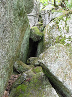
Grotto Cave near Beech Hill Pond in Otis Maine    Following the base of the cliff we came to the multiple entrances to the cave I had read about. The main entrance no longer had any steps leading up to it, just an old rotted log that was no longer useable. The cliff walls were too smooth for me to get a good enough grip to climb my way into the crevice so we carried on, finding other ways in. Everything was a little wet from the recent rain but we found a nice dry opening that required a little climbing but no crawling in the mud. That entrance ended up being the only one we could really get into but it was pretty cool.

Grotto Cave near Beech Hill Pond in Otis Maine     I did some more climbing and made it into another chamber but couldn’t squeeze my broad shoulders down into a tight squeeze that lead to another portion of the cave. I explored a bit, figuring out where the different cracks and crevices lead to. It’s a neat little talus cave system, nothing I would consider to be a real cave though. Only one tiny portion really required a flashlight and it was just a little too small for me to fit into. Jaime offered to help me carry over a log so I could climb into the main chamber but it wasn’t really necessary as I had seen it from above and knew which chamber it lead to. It was cool how they were all connected though.


Grotto Cave near Beech Hill Pond in Otis Maine     We bushwhacked our way back down, aiming for the road so we could avoid tight roping across the beaver damn but we came out right at the swamp anyway. This time we picked our way over rocks and logs on the lower side of the dam thinking it might be easier. Turns out it wasn’t but luckily nothing too strenuous. We explored an abandoned boat house along the jeep road we passed on our way out and made it back to the truck with lots of scrapes but no major injuries. Although the scratch a branch had left on the back of my knee was still burning hours later, I realized after my shower that a sliver of the branch was actually jammed in the cut. A pair of tweezers pulled it right out and it still hurts but not nearly as much as it did when the piece of wood was in my skin.

Grotto Cave near Beech Hill Pond in Otis Maine    After our successful adventure we headed into town to pick up supper. We each had a lobster, some corn on the cob and shared a few pounds of clams. Everything was incredible. It more than made up for the disgusting mussels we had a week ago that we ended up throwing out. Dicky’s looking forward to joining us on some of our Acadia excursions this summer.

    We were shocked to have actually found the cave on our first try considering we had no real directions and weren’t even sure if we were searching on the right hill. I figured it would take a few trips to find. Now that I’m looking at the information I took down about the cave off the geological website, there is no question we found it. Everything matches up exactly to their diagram. But I still can’t find any information on it whatsoever online, no pictures, nothing, so it looks like this will be the first.

Friday, May 13, 2016

Surprise Day Trip to NH

    Today I was supposed to go to Acadia by myself while Jaime went to work. I was planning on a semi-bushwhack up to the Featherbed and some possible cascades around it. But I ended up waking up at 6:15 with Jaime standing over me telling me I’d need to get ready if we planned on making it all the way to Mountain Fire Pizza and back in one day. Mountain Fire is our favorite pizza place but its located a good five hours away in Gorham NH. She called out so we could spend our 13 year dating anniversary together, just a day early since we both work Saturday.

    After finding some new directions that claimed to be shorter we hit the road a little after 7:00. I got a couple breakfast sandwiches from On The Run to eat on the road, which both kind of sucked, and we got some Dunkin for Jaime along the way. The directions were right and it only took three hours to get to Gorham which is great news because we’ll definitely be doing this again.

Mascot Pond Trail cascades Gorham NH
    Before eating we had to work up an appetite so Jaime decided beforehand that we’d hike out to Mascot Pond and the mine ledges. We first did it last year with my parents but the directions were not even close to right, making the hike twice as long as it should have been. This time we knew exactly where we were going which made for a much more pleasant journey. The streambeds that were almost completely empty last time were raging today, making for some nice cascades we stopped to take pictures of.

Mascot Pond from Mascot Mine in Gorham NH    Oddly the pond was no more full than it was last time, leading me to believe it might be spring fed, plus the fact that I haven’t been able to find a stream that feeds it. The Presidential Range wasn’t yet covered by the clouds rolling in so we could clearly make out the snow that still coats the higher elevations even in mid-May. I climbed up the ridiculously steep rockslide of mine tailings left behind from the 1800s when the mine was still in operation. Unfortunately it is closed off by a metal gate because bats hibernate there but the view is amazing and the air that flows from the tunnel feels like an air conditioner, nice when you’re sweating like crazy. I went up to the next ledge this time in hopes of finding more entrances which I’ve read exist, also sealed up, but I’d still love to see them. No luck this time.

Mascot Pond Trail cascades in Gorham NH
    I made my way back down without any difficulty which I’m proud of because I’m still new to the whole scree thing. Loose rocks on a steep mountainside doesn’t even sound like fun but sometimes its necessary to get to amazing places. As I reached the bottom we noticed a few raindrops, followed by a few more, as well as the Presidentials disappearing into the clouds. The drops got steadier as we made our way back to the car. So much for the zero percent chance of rain they predicted. The rain didn’t deter me from making my way down to a small waterfall I couldn’t quite get to on our way up. It was a single chute over an eight foot drop with no good vantage point due to its location at the edge of the power lines. If you’ve ever traveled beneath the power lines then you know what I mean, thorns everywhere. The surrounding brush got in the way of the pictures but it was beautiful in person.

   We attempted a shortcut on the way back that would have cut out another steep scramble, this one on loose dirt. But the trail took us all over creation in the wrong direction as it started to rain harder. Neither of us minded though so we just turned around and went back the way we’d come, making it back to the car before we go too wet.

Mountain Fire Pizza in Gorham NH - Maple & Bacon    We were the only people at Mountain Fire Pizza and ate the whole thing. Our favorite is the Maple and Bacon which I highly recommend, best pizza ever. Our table had a view out to some rock ledges on a hill in the general vicinity of Mascot Pond. After consulting the maps it is actually called Mascot Pond Spur and I plan on bushwhacking my way out onto the ledges next time, as well as a herd path that leads to the top of Mascot Ledges without any rock climbing involved.

Great Cut - The Gateway To Crawford Notch NH railroad    It started to really pour as we left Gorham and was becoming apparent today would be a washout. Not allowing that to stop us we headed for Crawford Notch to check out the Silver and Flume Cascades along the road which were quite impressive. I also decided I would check out the railroad tracks beside the road that travel through a blasted out ravine in the cliff. There was a photo of it at Mountain Fire labeling it “Great Cut, Gate Of Crawford Notch” and since I’ve wanted to explore it since I was a kid I figured this rainy day would be perfect. I got a little wet but it was awesome, I even got some yellow stones from a recent rockslide beside the tracks.

Mt Willard in Crawford Notch NH as seen from rock climbers trail
    Just down the road we pulled into a little unmarked parking area that’s always intrigued me. I wanted to scope it out to see if it was a good starting point for a later expedition up Willey Brook. It didn’t take long to realize there was an unofficial path heading in the direction of the Mt Willard ledges, leading me to believe it is the trail climbers use to get to the base of the imposing cliff. I followed it for a ways before it got too steep and slippery in the heavy rain.


Matt on Willey Brook in Crawford Notch NH    In the near distance I could hear rushing water, the Willey Brook I was looking for. So despite the pouring rain I made my way through a couple of old dried out streambeds, eventually reaching the brook. Through the trees I could see the train trestle not much further up the mountainside. There were no significant waterfalls, just small cascades flanked on one side by a steep forest wall that had recently suffered from some erosion. Unfortunately it was too slippery on the wet rocks to safely follow the brook up the ravine but my trip served its purpose which was just to scout out the area. Plus I finally figured out why those random parking spots were there, something I’ve wondered for as long as I can remember. I can’t wait to really explore the area.

GH Pizza in Lincoln NH - souvlaki & baklava
Sabaday Falls along Kancamagus Highway in NH    We hurried over to Lincoln hoping to get there before Chutters closed because we had our hearts set on fudge but we of course arrived 15 minutes late. So I went to GH Pizza to get a souvlaki which is basically a gyro but with chicken instead of lamb. While waiting for that I got a bowl of cotton candy ice cream next door, something I always get cravings for since the first time I had it there a couple years ago. Then we went to Black Mountain Burger for Jaime’s supper but the power was out in that plaza. So we hung around town for a little, checking out spots for future hikes, I went to the Price Chopper grocery store to get some of their pre-made pasta dishes which I love. All they had today was stuffed shells so I got that and this delicious apple/walnut/caramel pie that my dad and I got last year. By then the power was back at Black Mountain but they’d already given up and left early for the night. So in anger we’ve boycotted them, until next week when we decided we’ll probably go again.

Sabaday Falls along Kancamagus Highway in NH    Despite the rain we took the Kancamagus Highway over the mountain pass, cutting off an hour or so of travel. I’ve driven it so many times its not really scary anymore, even in the rain. We stopped at Sabaday Falls and I ran up the short trail to the falls. I once had some good pictures of it during high water but lost them when the external drive they were on died about five years ago. So I finally got to see it again when its raging and got some amazing pictures to replace my old ones.

Kancamagus Highway in NH    The ride home was treacherous. The rain got worse and our wipers both started to go so they weren’t doing the best job cleaning off the windshield. Add to that the fact that most of the way home was under some sort of construction so there were no lines on the road and it made for extremely slow and difficult travel. But we made it back home safely where I rechecked the weather report for the day I had looked at just that morning, yep, 0% chance of rain. Jaime fell right asleep and I enjoyed my souvlaki and baklava dessert, both of which were incredible. And in spite of the bad luck we had on Friday the 13th, we had an amazing day.

Friday, May 6, 2016

Waterfalls In Acadia

    Last night it rained half an inch along the coast so we decided today would be a great day to go check out some waterfalls in Acadia. Most people don’t even realize there are waterfalls on the island, but me, I knew I wouldn’t have enough time to see them all. And man is it amazing what a little rain can do.

    None of the Irving gas stations along the way had my broccoli and cheddar bites but the one in Ellsworth did have the fried green beans and onion rings I love, plus their banana bread. So I ate that while Jaime had an ice cream cone, a hot dog and onion rings at Jordan’s in Ellsworth. She wasn’t really feeling the whole hiking thing today, or anything for that matter, work has been stressing her out lately. We’re hoping she’s found a new job that pays even more but we won’t know for another few weeks. She hasn’t been herself lately so hopefully the new job will come through and she can leave all the stress and negativity behind.

Witch Hole Pond Brook Waterfall Acadia National Park Maine    The first place I wanted to hit was Witch Hole Brook, a short tributary stream that flows into Duck Brook through a steep ravine that I first discovered last August. Unfortunately it had been nothing more than a trickle after the extremely dry summer we had, so I hoped to one day go back when there was a little more water, figuring it would be pretty amazing. Rather than park at the high bridge over Duck Brook, we parked a little before that on a gravel pull off where an intriguing unmarked trail had caught my eye the last few times we drove by it. It appeared to go in the direction I was headed and looked easy to follow so I set out on my first adventure of the day.

Matt at Witch Hole Pond Brook Waterfall Acadia National Park Maine     The well worn path lead me straight to the start of Witch Hole Brook where it flows under the popular carriage path. I could hear rushing water as I drew closer, big rushing water, like a waterfall. Being the super cool dude I am, I might have skipped gaily before running the rest of the trail to the waterfalls. And they did not disappoint. I could see the white of falling water through the trees. The first drop of the 0.2 mile brook is only a few feet off the carriage path so its seen by at least a few people but most just walk on by, not even realizing that its there. While using the timer on my camera to take some pictures of myself at the waterfall, I slipped on the wet rocks and banged up my shin pretty bad. It only hurt for a little while and didn’t bleed too much but this is what happened the last time I went in search of waterfalls. Back in September in NH, at the very start of my expedition I slipped on a wet rock and hit my shin, other leg though. But it didn’t stop me then and it didn’t stop me today.

Witch Hole Pond Brook Waterfall Acadia National Park Maine
    Down stream, deeper in the ravine, the waterfalls get bigger. Unfortunately they’re too much to capture in photos because there are more drops than what the lens can see at once but it was more amazing than I thought it would be. The steep hillsides make navigating the ravine difficult but luckily the woods aren’t too thick so I just held onto one tree after another as I made my way down Witch Hole Brook. The rocks were slippery from the heavy rain but I didn’t have any problems after the first incident.

Abadoned Witch Hole Brook Trail steps Acadia National Park Maine
    I knew there had been a trail that once traveled along the brook but couldn’t see any signs of it last time. This time however I found the remains of a stone staircase which was pretty exciting. Its not exactly usable anymore seeing as it’s a bit dilapidated but its always rewarding to find proof that there was indeed a trail there, it really brings the dots on old maps to life. Why something so amazing was abandoned continues to boggle my mind but it gives me something to search for.

Witch Hole Pond Brook Waterfall Acadia National Park Maine
    When I first discovered the brook there had been one waterfall that really stuck out to me, I knew it would be something special if there had actually been any water. Today I was proven correct. The water poured over just right, leaving a shallow cave behind the wall of raging water, splashing off the rock at the bottom of the drop hard enough to hit the wall beside it. It was exactly as I’d imagine when I first saw it as nothing more than a trickle that dribbled into the small cave because there wasn’t enough force to even make it over the ledge.

    I crossed the stream just below my favorite cascade on the wet rocks and made my way up the eroded hillside just a few feet shy of where it empties into Duck Brook. I could have gone back the way I came but figured going up the ridiculously steep embankment would be quicker. I’m glad I did because while walking back to the car along the road I spotted some stone pillars I’d never noticed in all the years I’ve been driving by them. They look like they were maybe once part of a bridge but I can’t figure out why they’d be there, a few hundred feet from the actual bridge.

Whitecap Watershed on Cadillac Mountain above Eagle Lake in Acadia Maine
    Next we drove over to the pull off after the Cadillac Mountain auto road where we parked last time to explore Eagle Cascade and the Rinemold Arches. After seeing the amount of water in Witch Hole Brook, I knew Eagle Cascade would be impressive as well, not to mention the streams coming off Cadillac that feed Eagle Cascade. I’d been wanting to explore the brook above the park loop road but it’d always been low water, nothing more than a trickle down a granite slab. Today was a bit different.

Eagle Cascade upper falls between Cadillac Mtn and Eagle Lake in Acadia Maine    I slowly made my way down the brook towards Eagle Cascade. Its only 0.2 mile down to it but everywhere I turned there was another waterfall that needed its picture taken. My two previous visits were during times of fairly low water and although the stream was beautiful, it paled in comparison to what I witnessed today. That one little short stretch of stream was better than a lot of waterfalls I’ve taken difficult trails to get to. It’s a shame that there isn’t a trail here or even a name for that matter, because this brook definitely belongs on the map. I guess it makes it a little more special though since it isn’t.

Eagle Cascade between Cadillac Mtn and Eagle Lake in Acadia Maine
    Eagle Cascade was the biggest I’ve seen it in person but I did see a video where it was pouring over so hard it shot out a few feet in the air. It wasn’t quite that intense but it was roaring. Sometimes when waterfalls have too much water they lose their personality but today was absolutely perfect. I got a couple pictures with my timer by placing the camera on a log but was careful not to slip on the wet rocks while rushing this time around. Its funny, everyone else is taking selfies, I’m so advanced I’ve passed them all, gone back in time and reverted to using the timer function, you watch, it’ll be back in style someday soon. Its like a selfie that can capture your entire body.

    I crossed the river on some fallen trees and made my way up the other side to get a different view of the falls. Just above Eagle Cascade a slightly smaller stream merges with the big one so I followed it up to the road but its not quite as impressive as the larger one, still beautiful though with multiple drops worthy of photographing.
Matt and JR Libby from Lost And Abandoned Trails Of AcadiaRailway River Falls on Cadillac Mountain above Eagle Lake Acadia Maine    After a stop at the car for a drink, Jaime came over to check out the waterfalls that traveled under the road but she didn’t bother following them up with me. The sun was a little too bright so I wasn’t able to get any good shots of the roadside falls but they were pretty spectacular. As I started to explore I heard voices getting closer, probably the father and son I had seen up the road a ways taking pictures. As soon as we passed them I began to wonder if it was fellow blogger JR Libby and his son, Libby’s reports on abandoned trails are what got me into this hobby in the first place. So I ran down to meet them at the road, quite certain it was them. And sure enough, when I asked what blog he ran, he said Lost And Abandoned Trails of Acadia. I told them I was Matt from Leave The World Below and they just laughed like ‘holy shit its him’ because they’re fans of my blog as well. This was the first time we’ve met in person so I got a picture with both of them to commemorate the occasion. We chatted for a few minutes before I sent them off to find the poem in the wall of the Rinemold Arches, which I intentionally didn’t disclose its location online because I wanted JR to be able to see it and was worried someone else might move or take it if I said where it was. It truly was an honor to meet the guys who got me into this whole abandoned trail thing, especially this random meeting while we were both out in search of abandoned trails. Check out his site at http://lostandabandonedtrailsofacadianationalpark.webs.com/
Railway River Falls on Cadillac Mountain above Eagle Lake Acadia Maine
Railway River Falls on Cadillac Mountain above Eagle Lake Acadia MaineI carried on and made my way up the stream above the park loop road, not knowing what to expect but I knew there was something up there because I could see the white streaks of rushing water through the trees. But what I got was more than I ever could have expected. The stream ran down long angled slabs, down flume like ravines and canyons, poured over sheer ledges, over and under boulders. Simply amazing. It quickly split into not two but three separate streams that all ran side by side, sometimes crossing paths, forming side by side cascades that almost mirrored one another. The center stream was the smallest of the three but at one point it flowed through a dark gorge with fifteen foot high walls that I was able to get down into. One breath taking cascade after another for nearly a quarter of a mile. It finally leveled out and I decided to turn around. Now looking at it on the maps, it looks like it leveled out for only about fifty feet before it would have gotten more intense again. So I probably should have kept going but I didn’t want to leave Jaime waiting in the car too long and I’d already taken long enough. She wanted to head home after that but I’d say it was a successful day. There’s still a few more brooks I want to check out after a good rain so hopefully this summer won’t be as dry as last year.

    Now to catch up on a few things over the last couple weeks. We finally brought our totes of old clothing, mostly Jaime’s, to the Hands Of Hope thrift store where they give cash for clothes. We were going to have a yard sale but didn’t want to go through all the hassle so we just brought it there instead. We got a little over $20 for it which isn’t bad considering if we were to sell it at a yard sale we probably would have made roughly $20 off the clothing anyway and then donated the rest so this was a lot easier for the same amount. And while I was there I finally found a pair of desert camo pants, something I’ve been looking for for years now, and I do mean years. I need them for my Lost In The Sands album photo shoot so I didn’t want to spend $30 on them for a one time use, which is what camo pants cost, considering I probably won’t wear them after that. I could hardly believe my eyes, my size too. Finally. It’s been about a four year search.

12" Rotocast Skeletor
    My 12” Skeletor figure finally arrived, but it was broken. He was snapped in half at the torso which isn’t good considering it’s a $60 figure. But that’s the first one I’ve seen out of package so I decided to keep it, the seller refunded me twenty bucks and I was able to glue Skeletor back together. He can’t turn now but that’s okay, I wasn’t planning on playing with him anyway. Unless maybe I get bor- no, he’s for display purposes only. So he’s on display with my other new acquisitions on the fireplace. The figure really is a stunning piece, I love it.

Dragon Blaster Skeletor by Donnie Leffingwell
    A few days ago in the mail I got a package from Donnie in prison. He’s been working on some art for me and just finished a color drawing of Dragon Blaster Skeletor. He did an incredible job, now I’m searching for a frame to put it in. I can’t wait to hang it up. He’s become an amazing artist while behind bars. We got big plans when he gets out which is still a few years away but it’ll be nice to have a friend again. Plus he owes me for being his only contact to the outside world throughout his bid so he says he’ll do whatever stupid crazy ass dangerous hikes I want.

    I’ve been researching places to find in NH for this year’s vacation and I’ve got some good ones. After the mine I went into last year, I’m on the hunt for more of them and I think I found a bunch. Now, to actually locate them in real life. With all the hidden and forgotten waterfalls I found last year as well, I’m on the search for more and got quite a few to track down. It’s going to be a good summer for exploration.

Finishing Up NH Waterfalls

Up at 7:30, I ate my danish on the balcony and headed over to Kinsman Notch to check out the lower end of Clough Mine Brook. There were s...