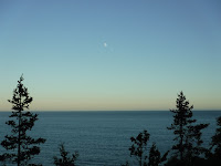
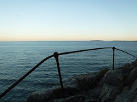
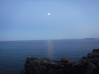
Thursday, September 29, 2016

NH Vacation (Day Four) - Crawford Notch Falls

    We got up early in the morning to make the trip to Crawford Notch to explore some waterfalls we’d first found about twenty years ago along the Mt Avalon trail and then do some other waterfalls in the area, hoping the streams wouldn’t be completely dried up. But as we were getting ready we realized we didn’t have the charger for Jaime’s tablet, which has all of the books and magazines she downloaded for vacation, her only entertainment. So I told my parents to head off without us and we’d meet them later in the day. The only way to buy a charger is to order it online because stores don’t carry them individually, a fact we’d learned the hard way before. The only way to get her a new charger immediately would be to go to Walmart where we bought the tablet, buy another one and use the cord from that, then return the new tablet when we got home. Luckily the Walmart in Littleton had the same tablet, just slightly newer and on clearance at that, so we’re just going to keep it as a spare. We ate some McDonalds and Dunkin Donuts breakfast along the way and made it to our first hike of the day just over an hour behind schedule.

    My parents’ car was still there in the lot so they hadn’t even made it back form the first waterfalls yet. We left a note on their windshield just in case we missed them along the trail, got our hiking gear all set, grabbed my Dunkin waffle sandwich and headed out to find some waterfalls on what was probably the clearest day of our whole vacation. As we were loading up my pack, we spotted one of the old couples we’d seen going up the Greeley Ponds trail the day before, we recognized them because the dude was awfully creepy and my parents were joking that he was an evil doctor who stole fresh body parts to replace his failing ones. Strangely, his arm that was in a sling yesterday seemed perfectly fine today, hmm. Right at the start of the trail we encountered a chipmunk who I conveniently dropped a piece of my waffle for, and then another piece. He sat at our feet gobbling it up, probably wondering what kind of deliciousness he was eating, and then my parents came around the corner.
Beecher & Pearl Cascade along A-Z Trail on Mt Avalon, NH

    The four of us went back to see the waterfalls they had just come from which amazingly did have a significant amount of water. The short cascade loop brought us to a couple falls but none of them were the ones I’d remembered. I distinctly remembered the stream passing through a narrow gorge with a waterfall at the head of it and although the ones along the trail were similar, they weren’t quite it. Oddly enough I couldn’t recall seeing those ones before but I knew the one I was thinking of actually did exist because I have a picture of it, dark and fuzzy because it was taken with a disposable camera twenty years ago, but I knew I wasn’t imagining it.
Beecher & Pearl Cascade along A-Z Trail on Mt Avalon, NH
    We got to the spot my parents had turned around at but I decided to keep going, just in case it was right around the corner. I gave them one of the walkie talkies and bushwhacked my way up the river. There were more waterfalls right above the one we were at, which makes me question why they stopped the trail when there were more falls just fifty feet away. I found some really nice waterslide cascades that would be impressive during high water but still no narrow gorge. Then up ahead, through the trees, I could make out a line of white squiggling down a cliff, I knew I was coming up to something good. Up and over a couple more smaller drops and there it was, the waterfall through the gorge I’d remembered. After taking a couple pictures and wondering how we’d gotten so far off the trail so long ago, I noticed a faint path on the other side of the gorge. Sure enough, it lead back to the trail, no sign for it like the others had. I informed Jaime and my parents to keep coming up the trail and I’d meet them halfway.

    A couple of older women were coming up the trail looking a little lost, which they most certainly were, they were going up the wrong mountain. So I directed them the way they wanted to go, they’d missed their turn at the very beginning of the trail. So I chatted with them until reaching my family. My parents noted the place they’d turned around because it was at the beginning of the steep part of the trail, so we slowly made our way up, luckily the falls weren’t too far up.
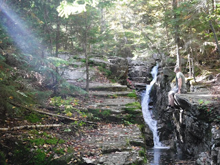
Matt at Fall Of Avalon Cascade along A-Z Trail on Mt Avalon, NH
    My dad recognized the falls right away, they were the ones he’d been searching for for years but couldn’t remember what trail they were on, he just had a mental image. How the lower ones got names and a trail to them yet this one gets nothing is beyond me, it really is a breathtaking cascade and much larger than I’d remembered. Jaime got some amazing pictures of me standing on the edge of the gorge with sun beams shining down on me through the trees. What’s weird is I remember being on the far side of the gorge, not the side with the trail on it, and back then there was a tree hanging over the falls, obstructing the view, which luckily is gone now. I’ll have to try to find my old picture of it and compare. I’d been wanting to go back there for years but figured the waterfall couldn’t be anything too spectacular since there’s no mention of it anywhere so I kept putting it off. Content with our rediscovery, we made our way back down.

    My parents were hungry so we stopped at the Willey House for a picnic where I got an ice cream cone, S’mores ice cream, omg. My parents got jealous and each got some ice cream as well, Jaime got jealous and finished mine, which is good because I wasn’t all that hungry after just having breakfast but for some reason Willey House ice cream is the best, I think it has more to do with location than flavor though. We examined Dad’s maps and my notes and decided to do the Bemis Brook off shoot of the Arethusa Falls path. They’d been there long ago and remembered it to be something special but I had never been.
Bemis Brook Falls, NH
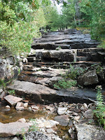
    Just after hitting the trail, Jaime waited in the car for this one happily reading magazines on her tablet as it charged, the train passed by so we got to see it up close and personal. The falls along Bemis Brook were incredible, like nothing I’d ever seen before. The rock formations here are different, they break away in brick like patterns so the water falls down staircases of stone that look chiseled out. It’s really quite unique and there was just the right amount of water flowing so you could really make out the distinct landscaping. I explored each fall, getting up close shots and side views, getting a little wet in the process but it was worth it. The trail was a bit tough and steep in parts but I feel like it traveled too high up on the ravine wall and might have missed some falls lower down, I’ll have to check it out some time, I could hear falling water below us. Arethusa Falls was still almost a mile away so we went back the way we came, Mom wasn’t too keen on doing the damn near vertical climb up to the main trail so I’ll have to go back someday to see the main attraction which I believe is considered to be the tallest waterfall in the state.
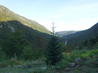
Matt at Hattie's Garden in Crawford Notch, NH
Crawford Notch from Hattie's Garden, NH
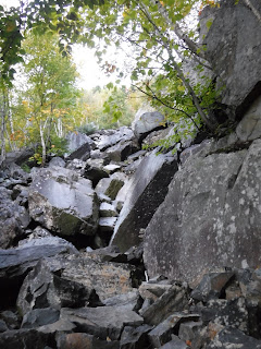
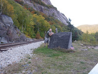
    From there, Mom and Dad headed back to Lincoln while Jaime and I parked at a random gravel lot at the foot of Mt Willard. On our first day trip to NH in the spring we stopped here but it was raining, pretty hard at that, so I explored the area a little but would have to come back to really check it out. I was on what I believed to be the rock climber’s trail up to the Mt Willard cliffs where you could follow the train tracks to an obscure memorial site by the trestle. That day I just bushwhacked over to the river and got some pictures of the small cascades but it was way too wet to hop around on the rocks safely. Today I followed the rock climber’s trail which turned out not to be, it was the unofficial trail that leads to the Mt Willard Section House memorial, which is right by the trestle like I’d expected. Man is that trail steep, I mean damn, I see why it’s not a publicized path. The view from the memorial was amazing, the foundation of the house still remains, as well as some old artifacts, with a sweeping view over Crawford Notch and a close up look at the imposing cliffs of Mt Willard and the precarious trestle you can see from the road on the steep mountainside. I could hear some water under the bridge so knew I’d have to go back down and follow the stream up, there was just no safe way down to it from where I was.
Willey Brook in Crawford Notch, NH (May)

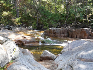
    After making the steep descent, I left the trail where I had a few months ago and cut across to the stream. Last time I could hear it through the trees a few hundred feet away, today, nothing. And with good reason, the brook was completely dry. I came out at the exact same spot I had the first time except the riverbed had absolutely no water in it, not even a puddle. I decided to follow it anyway, since last time there was too much water and it was too wet, this would at least afford me the opportunity to check for potential cascades. Although there were a few nice drops, there was nothing that looked like it’d be too spectacular, just some rocky rapids.
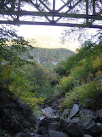
Willey Brook Trestle, Crawford Notch, NH
    Then the trestle came into view, towering over me, and I understood why I couldn’t find a safe way down from above. What was weird was the fact that I could hear running water not too far away, just on the other side of a rock pile. So I climbed over the boulders, logs and debris from the bridge to find the stream disappearing into the ground. From there on up the stream would reappear for small sections before getting lost under a boulder. Standing beneath the trestle was wild, I can only imagine when the train goes overhead. This was originally my turnaround destination so I checked with Jaime to see if she minded if I went further up and being the awesome wife she is, she told me to keep going.
Upper Willey Brook, Crawford Notch, NH (September)

    The terrain changed drastically here, as the smaller rocks that you can hop from one to another on gave way to boulders that I had to climb up and pick my way around. The walls of the ravine are insanely steep, so making this journey probably wouldn’t even be possible when there’s actually water in the brook. At times the tree cover opened up giving me a nice view across the valley to the ledges and slides on Mt Webster. Up ahead I could see what looked to be a rock wall with light shining down on it so I kept working my way towards it but the stream just seemed to keep going. I know for a fact it wasn’t that far in distance but the pace it takes to safely climb up giant boulders was really slowing me down. And the boulders just kept getting bigger, as did the fallen trees and logs blocking my path, which sometimes came in handy. I wanted to get to the split in the stream where the rocky ravine went off to the right at what I think will be an enormous waterfall but not today. It was getting late and just as I decided to stop and turn around, Jaime came over the walkie telling me she was starting to get hungry down there.
Willey Brook Trestle Crawford Notch, NH
    Figuring the way down would be more difficult and even slower going, I took to the trees on the inanely steep embankment and tried that. But the mountainside was so steep that I was just sliding down it, holding onto the trees for support. It was actually taking longer than if I just sat on my ass and plopped my way down from one boulder to the next. So back into the dry riverbed I went. The descent wasn’t as bad as I thought it would be, and in a lot of cases I found myself on the exact same path I took going up. Under the trestle I scooped up the rocks I found on my way up, lately I’ve been putting them in obvious places so I’ll see them on my way by and remember to grab them. Sweating like crazy, legs a little sore, I returned to the car with my goodies and we headed off.
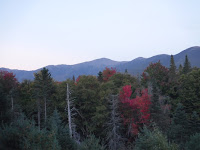
Eisenhower Wayside Area, NH
    On the way back to the hotel I stopped at the Eisenhower Wayside Viewing Area which is just a little hill along the side of the road with a spectacular view of the Presidential range. Being such a clear evening and with the sun setting, I wanted to stop and get some pictures. The problem is that the little hill is really steep so you don’t usually see people utilizing it. After a long day hiking I didn’t know if I’d be able to walk up it, so I ran instead. Surprising even myself, I made it without any difficulty and got some great pictures from the top. Then I ran back down.

    We stopped at the hotel to see if my parents were there to have supper together but their car was gone so we called. After a few rounds of phone tag, they had just left fifteen minutes ago to eat at the Chinese restaurant in town, as it turns out we were going to the restaurant directly beneath them in the plaza, Enzo’s. As we were looking over the menu they stopped in to say hi and see how my hike went, I told them to be glad they didn’t accompany me on this one. We ended up getting appetizers to go and then went to pick up Slouvakis from GH Pizza and brought it all back to the hotel. The appetizers were okay but the slouvakis were delicious, it was Jaime’s first time having one from there, now she understands why I always pick one up to take home with me when we leave. My sister arrived around 9:30 that night for her one day with us, she had class all week. We discussed our plans for tomorrow and called it an early night, I think we were asleep shortly after 10:00 which is just embarrassing.

Wednesday, September 28, 2016

NH Vacation (Day Three) - Ponds In The Clouds


East Pond NH
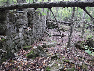
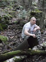
East Pond Tripoli Rd abandoned mill NH    On Wednesday Jaime wanted to sleep in a little so in the morning I headed off with Mom and Dad down the Tripoli Road to do East Pond. The trail from the other side of the mountain range is longer and steeper but I chose the easy side not because it was easier but because the first half of the trail is along an old road that went to the mill that once processed Diatomaceous Earth from the pond. I love abandoned buildings and old foundations so the pond wasn’t the main goal here, just a side attraction. Turns out that was a good thing because there really wasn’t much to see. It was a regular mountain pond, pretty, but they’re really only as impressive as the peaks around them. To be fair, the view might have been better had we not been in the clouds on the gray morning but there were no cool ledges or rock slides to liven up the view. Not to mention it was windy as hell up there and pretty cold, I was glad I wore my pants instead of my usual hiking shorts. This was actually the first time I’ve worn long pants hiking in quite awhile, shorts make it easier to move around, especially the way I hike. The four sizes too big camo pants were great except for the fact that the waist is so big that they bunch up beneath my belt, and Jaime makes fun of me for looking like a cross between the Insane Clown Posse and the Dudley Boyz.
Matt at East Pond Tripoli Rd abandoned mill NH

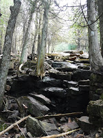
    After a short stay at the pond we stopped at the trail junction on the way down to look for the foundation of the old mill. It didn’t take long to find it, Dad had spotted it on the way up through the trees but we figured it couldn’t be that easy. It was. On the other side of a mostly dried up brook we came across old artifacts and then the remains of the mill. The walls of the foundation are still standing, as well as a number of iron rods sticking out of the ground. It was a pretty big place back when it was operational which wasn’t for very long, it didn’t turn enough off a profit so it was shut down after only a couple years of use back in the early 1900’s. Today it’s a cool place to explore and made for some good photos.
Otter Rocks picnic area along the Kancamagus

    We went back to the hotel to meet Jaime at noon and go out to get some White Mountain Bagel. We all ordered our sandwiches and went to the Otter Rocks on the Kancamagus Highway to have a picnic lunch. My god do they make the best sandwiches. Since the leaves are beginning to turn in the mountains, the leaf peepers are out in full force. A bus was just pulling away as we got there but there were still plenty of car loads hanging around while we ate. Our goal was to do the Greeley Ponds but the parking lot was full so we drove to the next stop where I remembered there being a river I wanted to explore. We started the hike and checked the map after we escaped the crowd of tourists but the trail went for over a mile and a half before even hitting the brook, definitely not something we were prepared for. The trail was nice and easy though, just not for today.

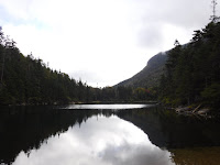
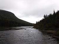
Greeley Ponds
Greeley Ponds

    Feeling like our luck might change, I convinced the rest of our party to go back and try Greeley again, which paid off because two cars were just leaving as we pulled in. The trail was wetter than I’d expected considering the lack of rain, so my parents were right, even though the trail had been redone since they hiked it last, it was still a muddy, wet, rooty, rocky trail that isn’t exactly easy. Overall I didn’t find it too difficult but it’s not the easy walk in the park most trail guides make it out to be. But the ponds at the top more than made up for it. I haven’t been to the Greeley Ponds since I was little and got covered in leaches while taking a swim.
Greeley Ponds
    By the time we got to the top it was getting a little late in the afternoon so Mom was worried we wouldn’t make it down before dark. I wasn’t worried at all, I’ve been hiking in the late afternoon enough to know that when you’re in a notch, the mountains block out the sun so you assume it’s getting dark out but as soon as you leave
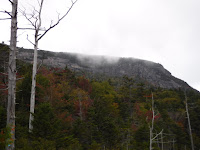
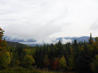
Greeley Pondsthe woods, bright sunlight. So Jaime and I explored while they waited at the first pond. You always see the same pictures of the notch from the pond so you don’t really know the other mountain peaks with the rock slabs, ledges and boulder fields are even there until you see it in person. The rugged feeling out there is incredible and we’ll most definitely be going back to explore some of the rockslides. We made it down to the second pond but didn’t want to keep them waiting so we took a couple pictures, peed beside the sandy beach and met back up with them at the top.

    On our way down we passed by way too many people heading up there that late in the day including old couples and families, none of whom were prepared for a hike like that. I hope they all made it down safely in the fading sunlight. Like I’d predicted, we made it down with plenty of time to spare. For supper we all went to Black Mountain Burger but me and Jaime weren’t too hungry so we split a burger and chili cheese fries. An excellent way to close out the day.

Tuesday, September 27, 2016

NH Vacation (Day Two) - Circling Moosilauke

Warren Woodstock Overlook on Route 118 in NH    Tuesday was supposed to be a rainy day but possibly clearing later so we started off by driving out to Rte 118 in search of the Jackman Brook Overlook. On the maps it looks like a roadside pull off with a view over the Woodstock valley and some brooks that cross under the road, joining a little further downhill before flowing into Elbow Pond. We saw no overlook and no brooks flowing beneath the road. A little further down we did find the Warren Overlook which had an amazing view despite the low cloud cover, no waterfalls though.
Baker Floodwater Reservoir

    From there we drove up the Ravine Rd towards the Moosilauke Lodge but the road was closed to vehicular traffic part way up for repairs. So we turned around and drove back down towards Warren where we stopped at a neat little streamside pull off. Dad remembered an old Sanitarium turned nursing home on the side of Moosilauke not far from there so we kept driving and came across the Baker Floodwater Reservoir on Rte 25. We walked out onto the dam for a great view over the water towards an imposing rock cliff known as the Benton Flats I’d never seen nor heard of it before. Quite impressive.

    Up the unmarked road, we found ourselves driving around the campus of the Glencliff Nursing Home, searching for the Long Pond Rd that began somewhere up there. It’s been remodeled since its days a sanitarium and looked quite nice but the old buildings around it gave it an eerie feeling. After driving in circles not finding our road, we left the way we came, hit the main road, got some pictures of the Benton Flats and then decided to go back and give it another try. This time we drove around the other side of the building in search of the dirt road and found nothing but an old creepy woman walking along the parking lot that my mom refers to as the goblin lady due to her posture. We thought it was a little odd that she would be wandering around but it is just a nursing home nowadays so maybe she was out taking a stroll. We looped around the building, still nothing, and then a piercing alarm started blaring, like a bomb siren alerting the townsfolk to seek shelter. It has definitely not been updated since the building’s days as a sanitarium. As we got the hell out of there, worried the alarm was because of us circling the building, we realized it was probably for the escaped goblin lady. Something very strange about that place. I’ve since looked it up and it’s not a normal nursing home, it’s a nursing home run by the state for the mentally ill and developmentally challenged. On our way out we found the dirt road we were looking for and left the strange siren squealing in the distance, making up stories about the goblin lady.
Long Pond in NH
    My parents had been out to Long Pond before and had trouble finding the road last time as well but we safely made it to the serene pond along the dirt road. We had a nice picnic lunch there as the clouds gave way to blue skies and sun. We walked out onto the fishing docks and over to the dam at the far end of the pond. I found a handful of neat rocks in the water but decided to leave them behind, I don’t really need more rocks, I have way too many as it is.
Beaver Pond in Kinsman Notch

    We stopped at the Beaver Pond at the top of Kinsman Notch on our way through and went off in separate directions to explore the area we’d first explored two years ago. Before going to the falls below the pond I went to check out the small tunnel at the base of the dam but it turns out it doesn’t go in very far and it gets too tight to crawl through. So I went around the shore of the pond to the large rock ledge that protrudes out into it, I’d always wanted to go out there but the last couple times I’ve been, the water was too high to safely cross the stream. With the drought we’re in, I hopped right across it and got to stand on the rock peninsula. The water is a lot deeper than I’d expected and the views from out there were spectacular. Even with the low water level, the falls beneath the pond were still impressive.
Lower Lost River caves along Route 112

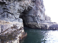
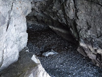
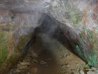
    Down on the other side of the notch we stopped at a small slab cave that leads to the river. I first found it earlier in the year but it was getting late and I didn’t have much time to explore the area. There was also some nice quartz at the bottom that I wanted a chunk of but didn’t have my tools at the time. So me, Jaime and Mom crawled through the cave to the rocky beach below. Dad has a bad shoulder and wouldn’t be able to rotate it the right way to make it down so he stayed above. At the bottom I climbed up some rocks and across a log, bringing me to a lower chamber of the cave. Past that there was yet another cave with two levels that I crawled through, meeting the biggest salamander I’ve ever seen along the way. What’s cool about all these caves is that just a few miles upstream is the Lost River Gorge, a famous string of caves along the river. On top of that, just a few hundred feet upstream is another boulder cave that a waterfall actually passes through. So I guess that river is just a breeding ground for caves.
Livermore Falls Pumpkin Seed Trestle Bridge
Livermore Falls
    Last year, on our way out to some waterfalls and a mine, we stopped at Livermore Falls for lunch. After eating down by a sandy beach, my dad and I explored a bit and across the river we spotted an old dam and the remains of a mill beneath the train trestle. We could hear people over there, families with kids, so we knew it was reachable from that side of the river and said we’d go find it this year. So today was the day. We drove down the road until we saw a dirt pull-off that seemed to be in the right general area. Sure enough, from the roadside parking we could see the top of the abandoned train trestle, popular today for bridge jumping. Of course it’s extremely dangerous and kids die here every year but it’s clearly a hangout. Garbage and beer bottles littered the way down to the stream and completely blanketed the floor of the old brick ruins. I couldn’t find a safe way down to the lower levels of the mill that I really wanted to explore so that’ll be another day’s adventure but I did go out onto the interesting rocks by the river to get a view of the waterfall. Even without much water, the Pemi River was raging in the small ravine, shooting mist into the air. The rock ledges were unlike others you see in the area as they were sharp and jagged, and just a few feet away they gave way to sandy beaches, not the rocky shorelines that border most of the mountain streams here. It was a crazy area I’ll definitely be coming back to.

Eagle Cliff over Echo Lake
    After our tiny picnic lunch, we were all ready for a good supper so we decided on Brittany’s, the restaurant above CJ’s Penalty Box that we first went to last year on vacation the night before Mom and Dad left. Me and Jaime went back a few months ago on one of our day trips to NH and even though they’re a little pricey, the food is delicious. I had the Stroganoff Burger again and although messy, it is incredible. However, by the time we were done eating it was only 5:30 which is way too early for me and Jaime to call it a night so we drove through the notch and stopped at Echo Lake. It was too cold to hang out for long so we drove down a road we hadn’t been down before into the village of Franconia before heading back to the hotel.

Monday, September 26, 2016

NH Vacation (Day One) - Not So Noble Falls

    We actually packed beforehand, for once, so there was no rushing around in the morning. We decided to take our new route to NH to avoid all the construction along Rte 302. Since we started going this way we've been wanting to check out a new development that they claim has views of the Presidential Range and it's own private hiking trails, both of which were true, it was definitely worth the little side trip. We made it to Gorham in just over 3 hours and stopped at Walmart for a bathroom break and to pick up a few groceries. Rather than travel down through Pinkham Notch and onto the Kancamagus like we’d planned, last second we decided to go towards Twin Mountain and down through Franconia Notch instead which got us to the hotel a few minutes after 2:00 which is exactly when we planned on meeting up with my parents.
    By this point we were pretty hungry so we went to White Mountain Bagel and got the Lumberjack to share so we wouldn’t spoil our appetite for supper. We might have also picked up some fudge from Chutters in Lincoln, but it was the only fudge we got all week. We took our lunch back to the hotel and ate by the river. We got room 4 this year which is one of the smaller rooms that doesn’t overlook the river but it’s okay, my parent’s room next door in 5 is better because it’s bigger and has a couch, a little bit jealous.
Noble Falls / Bridesmaid Falls (dry)
    After a quick lunch we headed out to Noble Falls with me driving for once, my parents in the backseat, because our new car is actually good. I’ve been monitoring the rain situation in NH for the last week hoping for some decent waterfalls but they didn’t get much, despite rain being in the forecast almost every day. A tree had fallen across the start of the trail since the last time we were here but nothing we couldn’t duck under, other than that the trail was in great condition and not too difficult other than the steep slope at the end to get down to the brook. But from above we could hear the waterfall, or lack thereof. Jaime stayed at the top of the ravine while the three of us navigated our way down to the falls, or should I say trickles. There was almost no water which was disappointing but my parents still loved it. The pool at the base of the falls didn’t even flow out down the stream, there was so little water it seeped into the ground and popped out ten feet away on the brook I had to carefully rock hop across last time.
Mountain Fire Pizza in Gorham NH
    I drove us over to Gorham for supper at Mountain Fire Pizza, my parents have been dreaming about it since last year. It was delicious but Jaime and I weren’t too hungry so we just got a small Maple and Bacon. Gas was a lot cheaper in Gorham so we gassed up and headed back, enjoying the blue sky and mountain views that weren’t in the forecast for the next week. I actually unpacked all of my stuff that first night which is very unlike me but made my stay much nicer. We got some much needed rain that night but not enough to enhance any of the waterfalls.

Tuesday, September 20, 2016

Dry Waterfalls and Abandoned Paths

    It was supposed to rain the past few days, especially along the coast so we’d been planning on going to Acadia to search for some waterfalls, despite Jaime still being sick. I planned on getting up early so I could hit all the potential waterfalls for my book in one day but we stayed up late last night talking and didn’t go to bed until about 4:00, something we tend to do when we have to get up early. After five hours of sleep I managed to roll out of bed and check the rain situation from last night only to find there had been none. In fact the entire past week only produced 0.07” of rain, weathermen lied again.

    We went anyway, stopping to get Jaime a lobster roll and ice cream along the way. Nothing good at Circle K this week, just some fried mushrooms which I enjoyed on the ride there, no broccoli bites or fried green beans. Acadia was covered in low clouds and fog, as we approached not a single mountaintop was visible which was a first for us. We’ve seen it foggy and in the haze but never low lying clouds that covered every summit, it looked like NH, which by the way we’ll be going to in just a few days for vacation.

    First stop of the day was to the unnamed stream I’ve called Railway River Falls, just to make sure there was no water. There wasn’t. The entire riverbed was nothing more than a trickle which is what I expected after seeing the amount of rainfall, but I needed to climb up it anyway for my book because I’d only ever been up it 0.2 mile, knowing it went another 0.3 or so up to the Cadillac Mountain Road. Since it’s going in my book I figured I should explore it all the way just in case there was something else worth mentioning up there. And it’s a good thing I did or I would have made a complete ass of myself.


Railway River Falls on Cadillac Mountain in AcadiaRailway River Falls cascade overhang on Cadillac Mountain in Acadia    I thought the falls I found on the lower section were spectacular, oh my god, the upper portion is breathtaking. After the flat portion where I’d stopped on my previous visits there is a fifteen foot cascade down a cliff with a smaller chute right above it, making maybe a 20 to 25 foot waterfall. Shortly after that was series of falls through a ravine. Of course they were close to dry so nothing much to look at today but it did offer me the opportunity to travel straight up the riverbed, and I do mean straight up as I climbed the waterfall from one section of the ravine to the next. I made my way up it, not intending to climb the entire thing, but just to see the small overhang caves behind the highest drop. By the time I made it to the caves, I only had one more level to make it to the top, so it would have been more dangerous to climb back down the slippery rocks. I tested it for about five minutes first, making my foot slip intentionally so I could get a feel for it and know what arm muscles I’d need to use to catch myself. Without anything to hold onto, I stood backwards and pushed myself up onto the wet ledge. Scary as hell but I did it and luckily there were no slipping incidents.

Railway River Falls ravine on Cadillac Mountain in AcadiaRailway River Falls on Cadillac Mountain in Acadia    The ravine didn’t stop there like I figured it would, instead continuing on through another deep gorge with flat cliffs on both sides a good twenty feet high. Now normally rock hopping up a stream is easy because the rocks are dry so you can literally hop from one to another. Unfortunately, the hundredth of an inch of rain we got last night made everything slippery and since the gorge is under tree cover, it didn’t dry out which made for a very difficult ascent and even more dangerous descent. At about this time I could hear sirens in the distance and our radio channel was being used by what sounded like a rescue team and the ones around it were also being used, probably by families driving up Cadillac Mountain, so we had to turn off our walkie talkies. I thought about turning back at the top of the ravine since we couldn’t get in touch with one another, Jaime being back at the car, but knew I was almost there so I kept going.

Railway River Falls on Cadillac Mountain in Acadia    What are the odds there could be another waterfall past the ravine? I mean come on, there surely would have been a trail along the brook at some point in time. But I’m the explorer here so I knew what I had to do. After the ravine opened up, it lead me to a steep forest that come Spring or a heavy rainfall would be submerged in water. The hundreds of paths the water would take were stunning, but up ahead I could see sunlight. Sunlight peaking through trees on a mountainside typically means something good is coming up. So I climbed up one of the dryer waterfall beds to find a sloping wall of rock before me with just enough water to sparkle on the granite. A slanted cascade, a hundred feet tall. Enormous. After measuring it on the map I realized a hundred feet was low balling it, the entire length of the cascade is 300 feet. Three hundred. I made my way out into the middle of it on the dry slabs of rock for a view of Eagle Lake and the cloud covered summits on the other side of it. Moss, four inches thick, bordered the streambed where small trickles of water passed beneath it at all times, making a lush forest floor.

    Hearing the auto road up ahead, I made it to the top of the waterfall until hitting the road which was quite busy despite the mountain being completely in the clouds. Knowing I’d need to come back in the Spring, I went down the other side of the river to see how safe it would be and make sure there’d be views of the falls. I thought traveling up the left side would be better but now that I think about, the right is steeper but the ravine walls are higher so there isn’t any overflow. The entire way down I was walking over muddy sections that were a good 40 feet from the stream so when it’s raging I don’t think it’d even be approachable from that direction. Near the top I took a tumble on some slippery rocks, luckily I wasn’t anywhere near the ledge so I wasn’t worried about falling to my death but I did bang up my elbow pretty bad. That’ll be sore tomorrow. To make up for that, I found a cool rock caught in some branches in the mud, a souvenir from my journey. Wet and sore, I made it back to the car, excited to tell Jaime about what I’d found.

Great Hill Abandond Standpipe, Acadia    From there we went over to the Witch Hole Pond parking area where I went up to the old standpipe used in the former water filtration system. It was a possible chapter for my book but there wasn’t much to see, just a giant steel tube, no cool stonework or anything. The one noteworthy thing about it is I went up a utility road that is still in use today but came down the old utility road which brought me to a rusty chain hung between two trees about ten feet from the trunk of my parked car. I didn’t even see the abandoned road literally right behind me, covered in weeds and baby trees. But the standpipe has been eliminated from my book which I kind of anticipated.

Witch Hole Mining Quarry, Acadia    Onto the Witch Hole Pond carriage path where 0.7 mile along it there had once been a mining quarry. So I ran most of the way there but couldn’t do the whole thing, shut up, most of it was uphill. To my surprise there was a clear path leading down to it, I kind of thought I’d have to search a bit. Also to my surprise, I wasn’t alone, there was a bike at the foot of the quarry and a gentleman across the way, sitting on a block of granite left behind from its days in operation. He mentioned that there were what appeared to be jumps and ramps here, a course for mountain bikers. That would explain the well worn path down to it. He was certainly correct, I found multiple man made ramps where people have rearranged the smaller granite blocks. It was kind of neat but nothing worthy of going into the book which means another scrapped chapter. I was hoping for large drop offs and big piles of rocks, deep pools of water, but it was all pretty flat, I think the highest ledge was maybe five feet. Oh well, moving on.

Latet Cave, Acadia
    I had wanted to go up the South Slope Slide and get some dark and ominous pictures from it but with the wet rocks, that would be beyond stupid. After one fall already, and bleeding scratches on both of my shins, I decided to play it safe and return to Latet Cave as I’ve come to call it. Latet means ‘hidden’ in Latin. We first found the cave early last summer but weren’t able to locate it again, after multiple attempts. About a month ago, while searching for the abandoned White Path, we found the cave again, but when I went to write my directions to it, we had no clue how we got there. All we knew was that we went into the woods a ways and followed the rock ledge, not exactly the most decisive directions. So today I planned on finding it and then walking in a straight line back to the road so we could give the most direct route, or hell, any route at all.

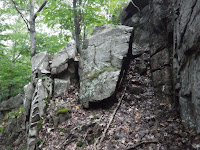
Abandoned White Path, Acadia    In my explorations I actually found another old section of trail we missed last year, despite being on it at least once. The stone steps were a little eroded but still visible, and useable as well. I knew I’d be coming up on the cave pretty soon, I had to be close, but I got sidetracked. The remains of the old trail began to lead upwards, up an easy graded slope located between a rock cliff on the right, and a drop-off on the left. It was the easy path we’d found last year up the ridiculously hard to climb rock ledges. We found it twice but both times were accidental, when we
Abandoned White Path, Acadiasearched it was quite elusive. But that was definitely it, no question. It was the old trail, we’d been on it all along. And to top things off, fifty feet beside it, along the lower ledge, Latet Cave, hiding in its boulder strewn corner. The two things I was looking for were right next to one another. I happily told Jaime what I’d found over the walkie talkies and she told me to go up and get the pictures I needed for the book since I was already there, despite her having to pee.

    So up the easy route I went, recognizing all the landmarks we’d taken
dry gorge on Abandoned White Path, Acadia
trail cave on Abandoned White Path, Acadianote of last summer. Despite having been there a handful of times, I had barely any pictures because the battery on both my camera and my phone were pretty much dead. The pictures I do have aren’t nearly good enough to go in a book, so I needed not just directions but photographic evidence that the amazing natural features on the side of the mountain really do exist. And sure enough, the easy path, which is actually steep, slippery and eroded, brought me to the exact spot I knew it would. Despite being a fairly difficult climb, it’s short and a hell of a lot easier and less dangerous than scaling the cliff like we’ve done before.

    I finally got pictures of the dry ravine that I believe had been a river after the last ice age due to the smooth, oddly shaped walls in the gorge. Not only did I take pictures, I took video too, so I’ll know exactly how to get there now. The path goes from the cave, up to the gorge, over a large crack in the rock with the assistance of some iron handrails, through a tight squeeze between a rock cliff and a boulder, then into a
Waterfall Rock on Abandoned White Path, Acadiaslab cave and ending at a rock wall we’ve come to know as waterfall rock. I took video footage of the entire trail so I can do an easy write up for it in the book, no more questioning how the hell I got there. From waterfall rock, you can follow the stream downhill and it’ll pop out right along the road which we discovered last time while searching for the trail. Put it all together and we have the start and end to a loop hike.

Champlain Mountain in the fog, Acadia    It got too dark to film anymore but getting back to Latet Cave was straight forward, following the remains of the old trail. From there, 160 steps straight through the woods brought me to the road. Not only to the road, but to our original starting place from last year. All we had to do was walk in a straight line, lol, we’d been going diagonal the whole time. So even though I didn’t find any new destinations for my book, I finished up three of the incomplete ones I had, making it a successful day.

Tuesday, September 13, 2016

The Sun And Moon Over Acadia

    I’m getting over my cold but Jaime’s is unfortunately just beginning. We had planned on going to Acadia today but when she started getting sick last night I knew that wouldn’t be happening because last week it was me canceling. But she woke up at 10:30 and decided she didn’t want to be laying around the house all day because it’d only make her feel worse. So we headed out a little late, surprisingly remembering to pack everything in our last minute rush, except for the walkie talkies. It’ll take a little while before we get used to having them but man are they great.

    I hadn’t eaten anything and amazingly they had all my favorites at Circle K, the broccoli and cheddar bites, the fried green beans, the macaroni and cheese bites and the onion rings. Jaime wasn’t hungry due to the cold so didn’t really get anything, just some blueberry bread because the banana was gone. We stopped at the Bear Brook Picnic Area for lunch, the weather was absolutely perfect. It was in the 70’s, a nice breeze, barely any clouds, that’s part of the reason we decided to go in the first place.

Huguenot Head and Dorr Mountain seen from Robin Hood Hill, Acadia
    After eating I decided to run up Robin Hood Hill to see if I could get some good pictures as mine from last time sucked, mostly due to the overcast day, partly due to the limited views from the previously unnamed peak. Running up didn’t go quite as planned, the cold was still kicking my ass so after coughing and wheezing for a good minute, I caught my breath and walked the rest of the way at a normal pace. The pictures came out fantastic on the bright and sunny day so Robin Hood Hill isn’t getting kicked out of my upcoming book like we thought it would.

    From there I wanted to head over to Schooner Head Road since it was just about low tide. Last time I was almost positive I spotted a sea cave in the distance that was under water at high tide. Of course it was from a distance so what looked like a cave was most likely just a small rock overhang that created a shadow but I had to find out for sure. So I made my way out around the huge patch of poison ivy and down to the barnacle covered rocks below the tide line. Even from a few hundred feet away, it sure did look like a cave. I carefully picked my way across the rockslide at the base of the fifty foot cliff where there was a cool overhang next to what had to be a cave.


Sea Cave in Acadia    Yes, there was an overhanging rock ledge and a small hole that both could have been mistaken for caves from a distance, and then there was the real deal, an actual sea cave, partially underwater even at low tide. It was huge, maybe 25 feet high by 15 wide, waves echoing from inside the giant chamber. A narrow rock ledge rounded the corner into the cave, giving me just a few foot shelf to stand on. From my perch near the roof of the cave I could see that it went back roughly 30 feet , maybe more as part of it was obstructed from view. The floor was covered in
Sea Cave in Acadiabattered stones that rolled around with every wave that crashed against them. I tried to find a way down but the rocks were too smooth to be able to climb them. I think in order to get into the cave I’ll have to go back at low tide on a calm day and swim my way into it. Unfortunately there’s no good place to tie a rope to so it’ll be a somewhat dangerous mission but I won’t be able to stop thinking about that cave until I get inside. There are also some amazing bands of quartz rock on one of the boulders that fell from the cliff, it looks almost like an exposed geode so next time I’m bringing my hammer and chisel to see if I can get a chunk.

Champlain Mountain from Highseas Summit    After spending more time than I intended down there I climbed up the nearby peak I’ve named Highseas Summit and got some good photos from the top to replace my dull ones from last time, another destination in my book that got saved from the chopping block due to a few incredible pictures. Not having the walkie talkies really sucked because we couldn’t stay in constant communication, I hate it when Jaime’s in the car worrying about me. They really do come in handy and we’ve only used them on two trips now, I’m not sure how we ever survived without them.

Champlain Mountain from Thrumcap Ledge    For our next stop Jaime decided to escort me. The fresh ocean air helped with her breathing a bit and we explored an area I’ve nicknamed Thrumcap Ledge. Last time it was raining and getting dark so I had to cut my exploration short so this time we went down an abandoned side road that brought us out to the shore where there was a rocky beach and a huge rock outcropping jutting out into the ocean that we climbed up. Found a few cool rocks along the way too.

Day Mountain Cliff Cave, Acadia    We planned on circling around and hopping back onto the park loop road but the street we needed was closed off for construction so we headed out to Day Mountain instead where I continued my search to re-find the caves. After two failed attempts I began to question how I was going to write a book directing people to awesome destinations if I couldn’t even get to them my damn self, and I’d been there before. So after exploring the side of the mountain the hard way, I finally found the caves. When I first went to the caves a couple years ago with my parents, there had been some recent rain and one of the caves required climbing a rope to get to it but it was too wet at the time. And the real cave of Day Mountain, an honest to god cave, was incredible, but my pictures weren’t. So I brought my tripod with me to get some better photos this time around.

Matt in Day Mountain Cave, Acadia    Unfortunately the rope into the first cave is gone and I wasn’t able to free climb my way up to the fifteen foot high entrance with my limited rock climbing ability. Maybe if someone had been with me, but not alone on the edge of a cliff. So I gave up on that cave early on and spent the majority of my time in the real cave. I took a bunch of measurements for my book and got some good photos and video as well.
Day Mountain Cave, Acadia
     I knew I was in there for awhile but I looked at my phone and it said two hours had gone by. In return I said oh shit and knew I’d have to run back, Jaime would be worried and probably out searching for me, thinking I got hurt or lost. No cell reception whatsoever. So I took note of where I was and found a much easier way to get to the caves so now they’ll be easy to find. I ran along the carriage path and got back to the car in record time where Jaime was waiting patiently, reading, not the least bit concerned. As I huffed and puffed, trying to regain my composure from my run, I apologized for being gone so long. She said it wasn’t all that long and sure enough it wasn’t, the clock in the car was an hour slow. Turns out my phone switched time zones and thought we were in Canada.

Moon over Hunter Cliff Trail, Acadia    From there we drove a couple minutes to an abandoned cliff trail along the shore that my parents and I stumbled upon about a month ago. I had some great pictures of it but with the moon coming out early tonight, I figured some shots with the moon would be great. Plus, there was a section I wanted to explore further but it required some free climbing which I don’t like doing unless Jaime is below me to tell me where to place my feet on the way down just in case I need help. So we found a better parking area for the hike that cut out almost all of the 0.7 mile trail, making it an easy five minute walk.

Abnandoned Hunter Cliff Shore Trail, Acadia    Aside from the nearly full moon there was also an enormous cruise ship that had docked in Bar Harbor earlier and was now headed out to sea, making for some perfect photos of it directly beneath the moon. With Jaime by my side I easily climbed the small ledge and got to explore the upper half of the abandoned trail. It’s amazing that after well over a hundred years, even with no maintenance, the iron railings are still standing strong. She got some video footage of me climbing the ledge and then some amazing pictures of me at the railing with the sunset over the ocean. We had a blast but the breeze had completely died off which brought out droves of mosquitoes.

Moon at Cooksey Drive Overlook, Acadia
    After taking a bunch of pictures we made our way back to the car but with the moon illuminating the sky, I ran down the new trail to an overlook and got a ton more photos of the moon over the ocean, reflecting off the water. I’m not usually by the ocean at night so this is the first time I’ve had a chance to photograph anything like this. With my new camera the pictures came out incredible. There was also a huge split in the rock cliff, creating what must have been a 40 foot drop as waves crashed inside the narrow crevice. Had it not been dark I would have explored it a bit more, maybe someday I’ll make it down in there during low tide.

Matt on Abnandoned Hunter Cliff Shore Trail, Acadia    So I only made it to a couple of my destinations but we had a great day anyway. On our way home I had a craving for Chinese food so we stopped at Asian Palace right before they closed and I had a delicious supper. My legs were a little sore the next day, mostly my quads, but man was it worth it. The pictures came out perfect, now it’s just a matter of narrowing it down and picking the best one from each spot. The book was complete at 40 destinations but I decided to bring it up to 50 so only a few left to go. We’ll try to get there next week before our New Hampshire vacation, so much to look forward to, I love it.

Finishing Up NH Waterfalls

Up at 7:30, I ate my danish on the balcony and headed over to Kinsman Notch to check out the lower end of Clough Mine Brook. There were s...